 © FijiPocketGuide.com
Where to Sail in Fiji
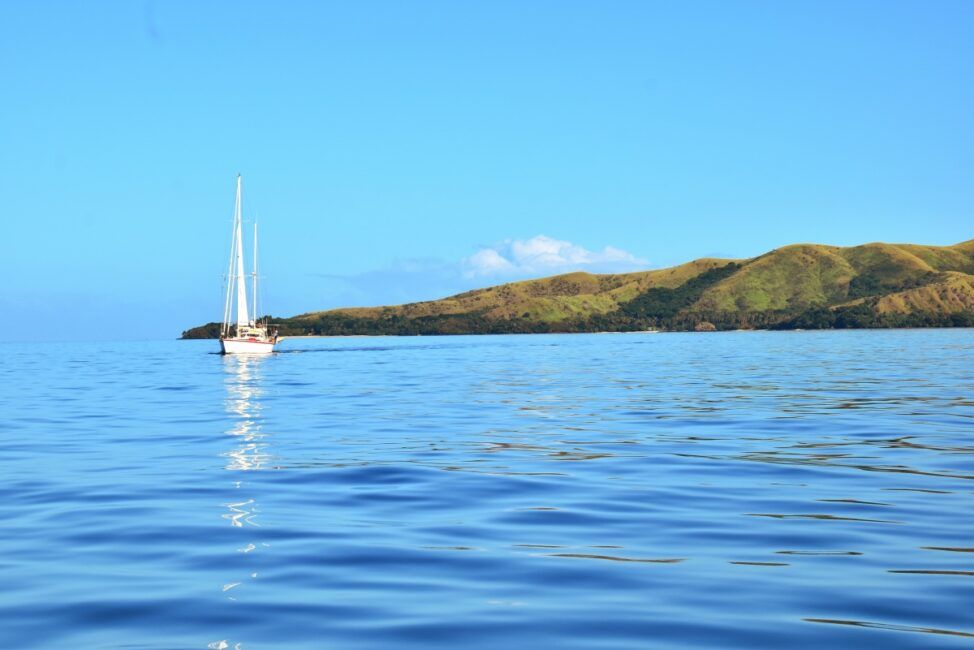
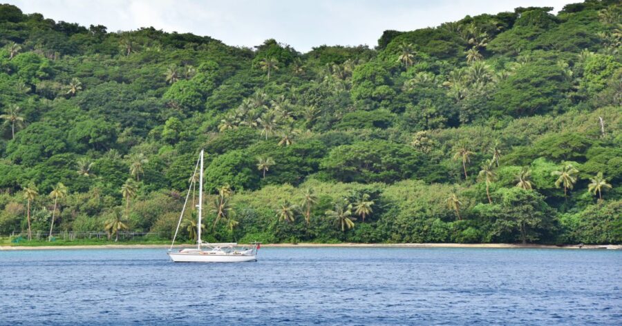
Fiji covers a whopping 18,376 km² (7,095 mi²) of the South Pacific with 333 islands. For sailing, there are five main regions from the comfortable and developed Mamanuca Islands to the remote and adventurous Lau Islands.
Sailing in the Mamanuca and Yasawa Islands
Outside of Viti Levu, Fiji’s main island, the Mamanuca and Yasawa Islands are the most frequented by holidaymakers. The islands are a mix of developed islands with resorts, as well as uninhabited islands and islands with villages.
The Mamanuca and Yasawa Islands provide something for everyone with idyllic beaches, snorkelling, diving, fishing, kayaking, island hiking and visiting resorts. There are anchorages at Malolo Lailai and Qalito islands in the Mamanucas and Matacawalevu, Sawa-i-Lau, Vawa, Naviti and Waya islands in the Yasawas.
Learn more about visiting these islands in A Sailing Guide to the Mamanuca Islands and A Sailing Guide to the Yasawa Islands.
Sailing in Kadavu
The waters between the islands of Kadavu and Beqa, the southern part of Fiji, are known as the Astrolabe Lagoon.
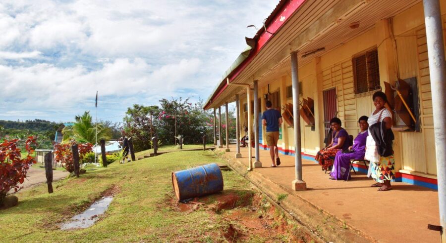
It is customary to present a sevusevu to the chiefly village on Dravuni Island before sailing in this area.
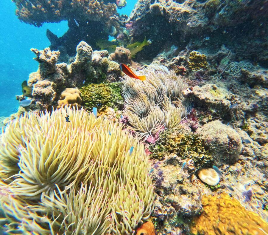
The islands have a good selection of beaches and excellent diving for experienced divers. Yachties might also want to take their tenders up to see the Kadavu Waterfall from Kadavu Village on the southern side of the island.
Find out more in A Sailing Guide to Kadavu: Anchorages, Clearance & More.
Sailing in Vanua Levu and Taveuni
In the northern reaches of Fiji are the large islands of Vanua Levu and Taveuni, both known for their areas of natural beauty and amazing scuba diving reefs.
Most yachties will enter the region via Savusavu on the south coast of Vanua Levu, an official entry port. There are several marinas and yacht services here, which you can read up on in A Sailing Guide to Savusavu: Marinas, Things to Do & More.
Further along on the southeastern coast of Vanua Levu, good anchorage can be found at Viani Bay and Buca Bay, while across the Somosomo Strait at Vatudamu Bay and the Paradise Taveuni Resort on Taveuni and the Rainbow Reef are other good options.
Aside from visiting the islands’ villages, beaches, resorts and reserves, some of the outer islands are worth a sail to, including Kioa and Rabi where displaced South Pacific Islanders present a unique culture in Fiji.
Learn more about this area in A Sailing Guide to Taveuni: Moorings, Anchorages & More.
Sailing in the Lomaiviti Islands
Just off the eastern coast of Viti Levu, it offers some interesting dive sites for serious divers in the Vatu-i-Ra Channel. The most popular island to visit is Ovalau, with the UNESCO site of Levuka town, the first capital of Fiji.
Yachties shouldn’t miss the opportunity to reach the less-visited islands of Makogai, which has a turtle and giant clam conservation sanctuary, a good anchorage, and the remains of a leprosarium. Gau Island is also worth an anchorage stay and boasts some good dive sites.
Learn more in The Complete Guide to the Lomaiviti Islands.
Sailing in the Lau Islands
The less-visited islands in Fiji, the Lau Islands, are a sailor’s paradise with a scattering of around 57 islands across the central to the eastern reaches of Fiji.
These islands have almost no tourism infrastructure, giving yachties a sense of the true South Pacific.
Note that you must first report to a port of entry before sailing in the Lau Islands, the closest being Savusavu in Vanua Levu.
Learn more about these islands in A Sailing Guide to the Lau Islands: Anchorages, Clearance & More.
 © FijiPocketGuide.com
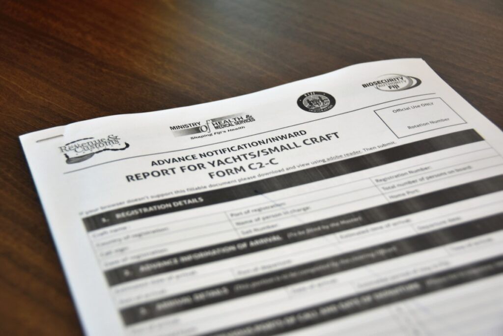
Clearing Customs for Yachts in Fiji
The Fiji Revenue and Customs requires that all yachts arriving in Fiji from overseas submit an Advance Notification form, known as the C2-C Form, at least 48 hours prior to their estimated time of arrival (ETA). This same 48-hour notice must also be given to the Ports Authority, Department of Immigration, Health and Biosecurity.
Ports of Entry in Fiji
The ports of entry to Fiji are as follows:
- Port Denarau Marina, Viti Levu
- Lautoka, Viti Levu
- Vuda Marina, Viti Levu
- Suva, Viti Levu
- Savusavu, Vanua Levu
- Levuka, Ovalau Island
- Rotuma
 © FijiPocketGuide.com
Yacht Clearance Process
On arrival at any port of entry in Fiji, yachts must fly the yellow Q flag and contact Port Control (usually VHF 16), which will usually ask you to swap to the relevant channel with the requested marina and/or put you in contact with Port Health, Agriculture Quarantine (Biosecurity), Immigration and finally Customs for Clearance upon arrival. Officials will enter the yacht for you to present the following documents:
- Completed Inward Report (including two copies of the crew and passengers lists)
- Completed Passenger Arrival Card
- Valid passports
- Clearance papers from the last port
- Valid outward airline ticket if crew/passenger is disembarking at the port of entry and leaving the country by air.
See the Fiji Revenue and Customs Service website for more information.
Note that Customs Clearance facilities are available from 8 am to 4 pm, Monday to Friday only. Weekend and public holiday clearances are permitted; however, overtime fees will be charged by the relevant government agencies. We advise avoiding arriving on a weekend or public holiday.
Immigration
Citizens from selected countries get a free four-month Visitor Visa upon entry into Fiji, established by completing the Passenger Arrival Card. Part of the Passenger Arrival Card will be detached and given back to you, which you need to keep, as it will be required for Immigration again when departing Fiji.
Learn more about immigration in Fiji in Do You Need a Visa to Visit Fiji?
Clearance Fees
- Fiji Revenue and Customs – FREE (Although an overtime charge of FJ$150 applies for clearances during lunch hour (1 pm-2 pm), weekends, public holidays and after hours.)
- Fiji Immigration Department – FREE (unless a visa is required)
- Biosecurity Authority – approximately FJ$200
- Fiji Ministry of Health – approximately FJ$170
- Marina Berthing Charges – FJ$30-$75 per night.
Cruising Permit
Before you set sail around Fiji’s stunning islands, you’ll need to obtain a Cruising Permit from the iTaukei Affairs Board. Whether you handle this yourself by visiting their offices in Lautoka or Suva, or arrange it through an agent, this free permit allows visiting yachts to cruise the Fijian waters legally.
The process typically takes one to three working days (longer over weekends), so factor this into your itinerary. Your yacht must remain at the marina until this permit is issued.
Valid for six months, it’s an essential piece of paperwork before you can explore Fiji’s incredible anchorages.
Departure Clearance
Yes, there are even formalities for leaving Fiji via a yacht, starting with advising Fiji Revenue and Customs at least 24 hours before your intended departure. You will need to berth your yacht at a Port of Entry and pay your port fees at the port office before proceeding with the Customs clearance procedures.
You will need your inbound clearance papers, crew details, the details of your vessel and your next port of call. You must then leave Fiji within 24 hours.
 © FijiPocketGuide.com
Restrictions and Protocols for Sailing in Fiji
Aside from the government protocols for sailing in Fiji, there are some cultural ones that you also need to be aware of.
Sevusevu Protocol
For many anchorages and sailing grounds in Fiji, it is customary to present a gift to the overseeing village, known as a sevusevu. This is typically yaqona (kava roots), but some remote islands may also appreciate gifts from basic stores, schoolbooks, stationery, and school and medical supplies.
It is recommended that you have enough yaqona for the number of villages and village anchorages you intend to use. Yaqona (pronounced “yang-o-na” or just ask for “kava”) can be purchased from the main markets in Lautoka, Nadi and Savusavu (the closest towns to the official ports of entry).
Check out Fiji Village Etiquette: What to Do When Visiting a Fijian Village for more information.
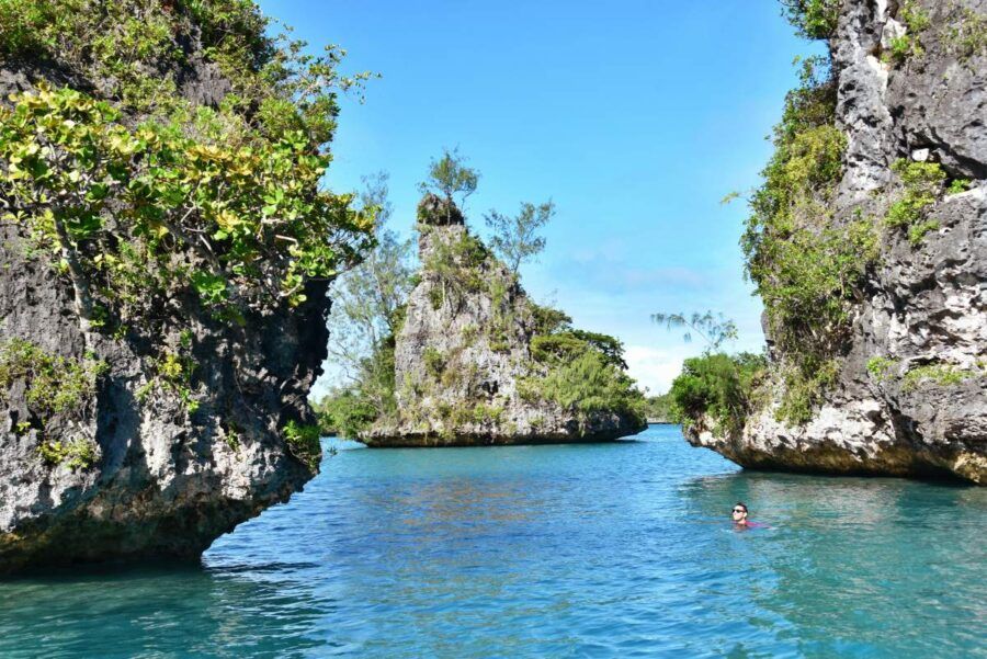
Marine Reserves and MPAs
Marine reserves and marine protected areas (MPAs) are areas where you cannot fish or take any marine life from the area.
While Fiji has a small number of marine reserves, such as the Namena Marine Reserve, Kiuva “Koula-Mai-Wai” Marine Reserve and Naiqoro Passage Marine Reserve, there are many marine protected areas, especially around resort islands. See a full list of MPAs in Fiji at The Guide to Ecotourism in Fiji.
How to Swim Sustainably With the Manta Rays
Best practices for swimming with manta rays centre on maintaining respectful and sustainable interactions to protect these gentle giants and their natural behaviour. When entering the water, do so quietly and calmly, keeping an initial distance of at least 10 metres to avoid disturbing them.
Ensure your fins remain below the water’s surface to minimise splashing that could startle the rays. Swimmers should never approach closer than 3 metres and must never attempt to chase or touch a manta ray.
Always approach from the side, giving the animal a clear and unobstructed path to swim freely.
Scuba Diving Etiquette:
- Hover low and stay to the side of cleaning stations.
- Avoid swimming directly over or through these sites.
- Never block the manta ray’s path.
General Snorkelling Etiquette:
- Keep a minimum five-foot distance from all marine wildlife.
- Do not stand on or kick coral.
- Avoid shallow reefs to protect both yourself and the ecosystem.
- Do not touch any marine life.
- Use reef-safe sunscreen or UV-protective clothing.
- Enter and exit the water gently to minimise environmental impact.
- Collect ocean plastic if spotted while snorkelling to help reduce marine pollution.
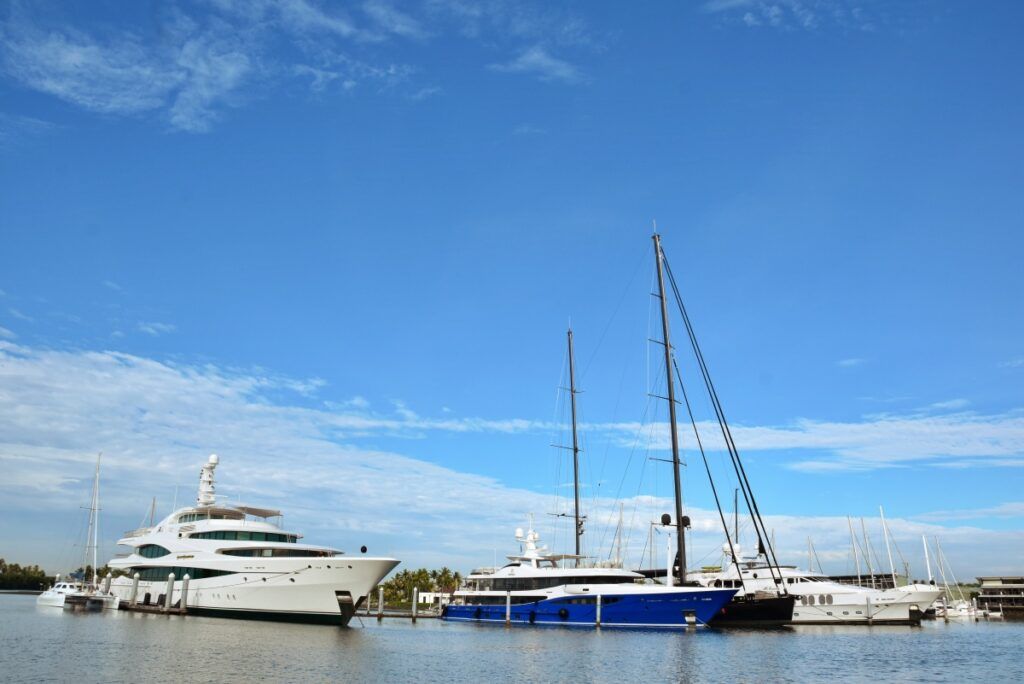
The Main Anchorages and Marinas in Fiji
What’s that? All of Fiji’s main marinas and anchorages in one easy-to-follow table?! That’s right, and it even includes contact details. You’re welcome.
| Anchorage/Marina Name | Anchorage/Marina Description | Anchorage Location (GPS Coordinates or Contact Info) |
|---|
| Port Denarau Marina | Marina berths (52) & swing moorings (16) | +679 675 0600; [email protected], http://www.denaraumarina.com |
| Vuda Marina (Vuda Point) | Marina berths (150), cyclone pits (90) & hardstand spaces (60) | +679 666 8214; [email protected], http://www.vudamarina.com.fj |
| Royal Suva Yacht Club (RSYC) | Swing moorings; limited dock space | +679 331 2921 |
| The Pearl Resort Marina (Pacific Harbour) | Marina berths (≈10) with basic services | +679 773 0022, http://www.thepearlsouthpacific.com/en/marina |
| Levuka Wharf (Port of Levuka) | Town wharf & anchorage (Port of Entry) | +679 344 0189 (Levuka Port Office) |
| Musket Cove Island Resort & Marina | Marina berths (10) & mooring buoys (26) | +679 666 2215, http://www.musketcovefiji.com/yacht-club-marina |
| Nanuya Island Resort (Blue Lagoon) | Mooring buoys & anchorage (visiting yachts welcome) | +679 603 0902; [email protected] (Resort) |
| Copra Shed Marina (Savusavu) | Marina berths (~30) & swing moorings | +679 885 0457 |
| Savusavu Marina (Waitui) | Swing moorings (≈20, cyclone-rated) | +679 885 3031 / +679 997 2558, http://www.savusavumarina.com |
| Nawi Island Marina | Marina berths (132, incl. superyacht berths) | +679 885 3033, http://www.nawiisland.com |
| Paradise Taveuni Resort | Mooring buoys (9 free for guests/visitors) | +679 888 0125; [email protected], http://www.paradiseinfiji.com |
| Taveuni Dive Resort (Taveuni Estates) | Mooring buoys (2–3; for visiting yachts) | +679 891 1063; [email protected], http://www.taveunidiveresort.com |
| Laucala Island Marina | Private resort marina (limited berths) | +679 888 0077 |
| Kokomo Private Island (Yaukuve Levu, Kadavu Group) | Private dock & anchorage (resort guests only) | +679 776 4441; [email protected] |
| Royal Exploring Isles Yacht Squadron (Bavatu Harbour) | Anchorage with limited private moorings | N/A (Caretaker managed) |
Viti Levu Anchorages
| Anchorage/Marina Name | Anchorage/Marina Description | Anchorage Location (GPS Coordinates or Contact Info) |
|---|
| Royal Suva Yacht Club | Major marina in Suva offering moorings, slips, dinghy dock, fuel, laundry, chandlery, showers, and bar. Temporary membership required. | [email protected] |
| Suva Anchorage (Novotel Bay) | Very protected anchorage near Novotel, northwest of RSYC. Solid holding in 6 m mud. Close to police boats for added security. | 18°06.58S / 178°23.76E |
| Pacific Harbour Anchorage | Tight and shallow river entrance, no marina. Local liveaboard “Charlie” may offer dock space. Strong tidal current. | [email protected] |
| Port Denarau Marina | Fiji’s largest full-service marina with haul-out, fuel dock, shops, restaurants, and customs clearance. Access card required for facilities. | [email protected] |
| Yakuilau Island Anchorage | Calm alternative to Denarau anchorage behind Yakuilau Island. Long dinghy ride to shore but well-protected from swell. | 17°45.812S / 177°21.805E |
| Marina Naisoso | Small, modern marina with floating docks. Mostly leisure boats. No showers or laundry. Entry advised only at high tide. | [email protected] |
| Vuda Point Marina | Popular cyclone-season marina with haul-out, chandlery, fuel, restaurants, and workshop access. Berths fill fast; reserve in advance. | [email protected] |
| Saweni Bay | Well-known calm anchorage near Lautoka. Mud bottom with good holding. Beach landings possible. Close to Vuda Point. | 17°36.000S / 177°25.000E |
| Bekana Island | Anchorage near Lautoka with ferry access and resort onshore. Some moorings in use. Dinghy dock may require $5 fee. | 17°35.5078S / 177°26.7641E |
| Volivoli Point | Anchorage with good holding in mud. Cruiser-friendly resort nearby with no fee to go ashore. Scenic northern coastline of Viti Levu. | 17°18.844S / 178°10.370E |
Mamanuca Islands Anchorages
| Anchorage/Marina Name | Anchorage/Marina Description | Anchorage Location (GPS Coordinates or Contact Info) |
|---|
| Musket Cove Marina | Full-service marina and anchorage with access to shops, fuel, showers, laundry, pool, restaurants and bars. Moorings available; call ahead on VHF 68. | [email protected] |
| East Side Malolo Island | Anchorage between Malolo and Malolo Lailai in 16 m sand. Less crowded than Musket but known for being rolly. | 17°45.604S / 177°11.839E |
| Seventh Heaven Anchorage | Anchorage near overwater restaurant. Landing fee applies. Great for lunch stop or dinghy visit with snorkelling nearby. | 17°47.827S / 177°11.463E |
| Cloud 9 / Roro Reef | Multiple sand-bottom anchorages around floating bar. Stunning visibility and popular snorkelling area. Depths from 3.5–10 m. | 17°47.4869S / 177°07.967E |
| Namotu Island | Anchorage near the surf break. Limited space. Private island—no shore access allowed. | 17°50.477S / 177°10.932E |
| Qalito Island (Castaway Resort) | Day anchorage in 20 m sand west of island. Welcoming to cruisers. Not the real Cast Away film location. | |
| Mociu Island | Private honeymoon island owned by Likuliku Resort. Good snorkelling, but no shore access permitted. | 17°41.3083S / 177°08.859E |
| Waidigi Island | Private island, often referred to as “Google Island.” Anchoring is possible, but shore access and swimming are prohibited. | 17°45.131S / 177°08.580E |
| Mana Island | Anchorage within the lagoon near resorts. Clearly marked curved entrance. Anchor between bommies with care. Sevusevu not required. | 17°41.078S / 177°06.794E |
| Monuriki Island (Cast Away Island) | Famous film location. Anchoring permitted only after doing sevusevu on Yanuya Island and paying FJD $20 per person. | |
| Tokoriki Island | Anchorage in front of resort is not permitted. Resort staff may ask boats to move or use designated mooring. | |
Yasawa Islands Anchorages
| Anchorage/Marina Name | Anchorage/Marina Description | Anchorage Location (GPS Coordinates or Contact Info) |
|---|
| Likuliku Bay (Octopus Resort, Waya) | Sandy-bottomed anchorage in front of Octopus Resort. Good holding and protection, but keep clear of ferry path. Dinghy access marked by floats. | 17°16.553S / 177°06.263E |
| Blue Lagoon (Nanuya Lailai) | Busy anchorage between Nanuya Lailai and Matacawa Levu with resort access and nearby underwater caves. Watch for bommies. | 16°56.575S / 177°21.836E |
| Nacula Island (Blue Lagoon Resort) | Anchorage in marine protected bay in front of Blue Lagoon Resort. No fishing or spearfishing permitted. Resort is cruiser-friendly. | 16°53.466S / 177°24.588E |
| Sawa-i-Lau (Underwater Caves) | Anchorage near limestone caves. Sevusevu with Nabukeru village required. Famous site from the film “The Blue Lagoon.” | 16°50.496S / 177°27.894E |
| Drawaqa Island (Manta Rays) | Access via Cuvu Bay. Popular for snorkelling with manta rays. Reef between Drawaqa and Naviti is not passable by boat. | |
| Naviti Island (WW2 Plane Wreck Bay) | Day anchorage near a WWII airplane wreck in shallow water. Snorkelling and friendly village nearby. | 17°05.540S / 177°17.391E |
| Viwa Island | Remote anchorage off Naibalebale village. Access through narrow reef passes. Rarely visited with friendly locals. | |
| Kuata Island | Anchorage near Barefoot Kuata Resort. Offers a lovely beach and hiking trail to caves with summit views. | 17°21.958S / 177°07.973E |
| Naukacuvu Island | Anchorage on NE side of island in sand. Watch for wind, wave and current interactions. Nearby alternative anchorage has better conditions. | 17°11.691S / 177°10.597E |
| Yasawa Island (South) | Anchorage at southern end of Yasawa Island. Remote, peaceful and with easy access to village experiences. | 16°49.226S / 177°27.881E |
| Yasawa Island (Yasawairara) | Northern anchorage in shell sand. Among the best beaches in the Yasawas, excellent holding and calm waters. | 16°42.557S / 177°34.574E |
Beqa Anchorages
| Anchorage/Marina Name | Anchorage/Marina Description | Anchorage Location (GPS Coordinates or Contact Info) |
|---|
| Malumu Bay (Beqa) | Deep, protected anchorage with excellent mud holding in 5 m. Very calm with lush hillsides, except in northerly winds. | 18°23.223S / 178°09.126E |
| East Frigates Pass | Anchorage in 6 m of sand with access to surf break. Less bommies closer to shore. Good for day anchorage or overnight in calm weather. | 18°28.1330S / 177°56.6146E |
| Yanuca Island – Central Anchorage | Anchorage in 6–8 m with coral and sand bottom. Good protection from trade winds with patchy sand areas requiring careful approach. | 18°22.624S / 177°59.284E |
| Yanuca Island – Alternative Anchorage | Slightly deeper patch in 8.5 m. Some coral rubble, but anchor held with plenty of scope. Light winds and minimal swell. | 18°22.641S / 177°59.228E |
| Yanuca Island – Coral-Friendly Anchorage | Coral-conscious anchoring area. Requires visual guidance or dinghy scout. Good protection in 4–10 m with light trade winds. | 18°22.654S / 177°59.317E |
| Yanuca Island – Google Anchored Spot | Anchored with satellite imagery. Reasonable protection. Suitable for monohulls in patchy sand/coral conditions. | 18°22.55’S / 177°59.36’E |
Lomaiviti Anchorages
| Anchorage/Marina Name | Anchorage/Marina Description | Anchorage Location (GPS Coordinates or Contact Info) |
|---|
| Levuka (Ovalau) | Anchorage directly in front of town in 30 ft mud bottom. Exposed to SE winds, but convenient for customs and provisions. Dinghy access via tuna cannery pier. | 17°40.929’S / 178°50.158’E |
| South Ovalau – Hurricane Hole | Sheltered anchorage option south of Levuka, though not fully protected. Used during poor weather as a safer option than town anchorage. | 17°44.09S / 178°45.99E |
| Caqalai Island | Anchorage off small Methodist-owned island with rustic accommodations. Calm and friendly stop between Levuka and Suva. | 17°44.15S / 178°43.80E |
| Toberua Island | Anchorage off manicured resort on reefy area between Ovalau and Viti Levu. Offers restaurant, diving and staff hospitality. | 17°58.58S / 178°42.17E |
| Makogai Island – Dalice Bay | Deep anchorage in marine protected bay near clam farm. Sevusevu with staff. Remains of old leper colony and dive sites nearby. | 17°26.322S / 178°57.232E |
| Naigani Island | Well-sheltered anchorage in sand and clay bottom. Scenic and calm even in strong wind. Popular rest stop en route to Ovalau. | 17°34.306S / 178°40.647E |
| Wainaloka (Ovalau) | Deep, protected anchorage surrounded by mangroves. Accessible via mangrove tunnel. Village offers traditional welcome ceremonies. | 17°44.230S / 178°46.104E |
| Koro Island – Dere Bay | Anchorage with some bommies not visible on satellite charts. Deep water with good holding. Quiet and scenic setting. | 17°16.436S / 179°21.628E |
| Gau Island – Bay of Angels | Anchorage near manta ray area. Entry via Wakaciva pass. Sevusevu required at Sawieke village. World-class diving nearby. | |
Savusavu and Vanua Levu Anchorages
| Anchorage/Marina Name | Anchorage/Marina Description | Anchorage Location (GPS Coordinates or Contact Info) |
|---|
| Savusavu (Copra Shed Marina) | Full-service marina offering moorings, entry clearance support, showers, provisioning nearby and vibrant cruiser community. | [email protected] |
| Waitui Marina | Simple mooring area with basic dinghy dock and bar. Staff can assist with formalities and launch service. | [email protected] |
| Savusavu Marina | Private marina south of Copra Shed with long-term berth options. Dinghy access, moorings and haul-out nearby. | [email protected] |
| Nawi Island Marina | Modern full-service marina on Nawi Island offering berths, moorings, fuel, water and customs support. | [email protected] |
| Jean-Michel Cousteau Resort Anchorage | Anchorage near Jean-Michel Cousteau Resort, calm in prevailing winds with easy access to snorkelling. No shore access unless using the resort. | [email protected] |
| Rokocivia Bay | Quiet bay offering good shelter and scenic views, but no facilities. Often used as a stopover. | |
| Namena | Well-known anchorage near Namena Marine Reserve. Great for diving but exposed in some conditions. | |
| Nabouwalu / Coconut Point | Next to ferry terminal with easy access to shore, but occasional surge. Used as a stopover between passages. | |
| Bua Bay (Lekubi Point) | Large calm bay with room for multiple boats, good holding. No major facilities. | |
| Yadua Island | Sheltered spot near a traditional village. Sevusevu required. Remote and peaceful with coral nearby. | |
| Yadua Taba | Anchoring prohibited. Island is protected by the National Trust and closed to visitors. | |
| Viani Bay Anchorage | Sheltered spot with access to Viani Bay Resort, which can provide meals, scuba diving activities, transport for provisioning and more. | [email protected] |
Taveuni Anchorages
| Anchorage/Marina Name | Anchorage/Marina Description | Anchorage Location (GPS Coordinates or Contact Info) |
|---|
| Paradise Taveuni Resort | Resort on the southwest coast of Taveuni offering 10 free moorings and access to showers, restaurant, fuel, and PADI dive services for visiting cruisers. | [email protected] |
| Laucala Island Marina | Private resort marina (limited berths) | +679 888 0077 |
| Taveuni Dive Resort (Taveuni Estates) | Mooring buoys (2–3; for visiting yachts) | +679 891 1063; [email protected] |
| Vurevure Bay | Spacious bay on the east coast with a mooring buoy behind pearl farm buoys. Protected from SE swell but filled with coral, so navigation must be cautious. | 16°47.786S / 179°50W |
| Naselesele Point / Matei | Anchorage near Matei and Taveuni Airport with access to town. Rolly at times but offers several sandy patches between bommies. | 16°41.583’S / 179°53.701’W |
| Waiyevo / Somosomo | Anchor well south of Korolevu Island to avoid bommies. Basic provisions and hardware available ashore. | |
| Namata Bay (Qamea) | Friendly and welcoming anchorage known for bommies and calm conditions. Visitors are welcomed by the Mitchell family and encouraged to sign the guest book. | 16°44.739’S / 179°46.338’W |
| Naiviivi Bay (Qamea) | Scenic and calm anchorage with several bommies and shoaling areas. Requires careful entry using satellite images. | 16°45.8506S / 179°46.8583W |
| Matagi Island (Horseshoe Bay) | Private anchorage near boutique resort. Stunning setting with excellent diving nearby. Permission required to go ashore. | 16°43.822S / 179°44.668W |
| Albert’s Cove (Rabi Island) | Protected anchorage on Rabi’s north side. Good snorkelling and shelter from trade winds. No village, but daily longboat traffic. | 16°26.811S / 179°56.392W |
| Elizabeth Cove (Rabi Island) | Anchorage near a small village on Rabi with superb snorkelling and friendly children. Vodafone reception available. | 16°27.594S / 179°57.975W |
| Catherine Bay (Rabi Island) | Quiet bay with 10 m depth. Large church visible on shore. Use caution due to uncharted reefs. | 16°31.607S / 179°59.426W |
| Kioa Island | Anchorage within the reef, surrounded by reef on three sides. Local Tuvaluan community known for artisanal fishing. | |
| Viani Bay Anchorage (Vanua Levu) | Sheltered spot across the Somosomo Strait with access to Viani Bay Resort, which can provide meals, scuba diving activities, transport for provisioning and more. | [email protected] |
Kadavu Anchorages
| Anchorage/Marina Name | Anchorage/Marina Description | Anchorage Location (GPS Coordinates or Contact Info) |
|---|
| Muani Village / Yauravu Bay | Anchorage east of Muani with deep sand bottom. Calm spot for northern wind conditions. Sevusevu is required in nearby villages. | 19°09.346S / 178°07.337E |
| Cape Washington (Denham Island) | Beautiful bay near abandoned resort. Coral heads and shifting winds make this anchorage better suited for short stays. | 19°07.660S / 177°57.048E |
| Talaulia Bay | South of Taiwava village. Well-protected from SE winds. Quiet bay with no major services, but scenic coastal views. | 19°06.084S / 178°00.572E |
| Soladamu | Anchorage with sevusevu and local produce available. Calm waters and welcoming village on the north coast. | 19°04.250S / 178°06.900E |
| Vunisea | Anchorage in front of Kadavu’s fuel dock and close to airport. Some yacht services and market available. | 19°02.911S / 178°09.262E |
| Naigoro Bay | Popular anchorage near the marine reserve. Entry requires sevusevu at Naigoro village. Well-protected in sticky mud. | 19°00.368S / 178°28.553E |
| Matasawelevu (Ucuna Naigoro Bay) | Anchorage behind reef offering protection from trade winds. Calm in 16–20 m sand and mud. Entry requires care. | 19°00.296S / 178°28.625E |
| Vatululu Bay | Anchorage in 23 m of mud. Not well charted in Navionics; best entered using satellite imagery. | 19°00.411S / 178°28.629E |
| Korolevu (Vaca Levu) | Nice anchorage reached via Korolevu Pass. Strong incoming tide possible. Caution with reefs entering. | 19°01.344S / 178°24.456E |
| Vonobia Island | Anchored in mud. Sheltered bay with mangrove channels and scenic beach. Good protection, though coral condition is mixed. | 19°02.720S / 178°19.365E |
| North Bay / Soso Pass Sandbar | Anchorage in sandbar area, suitable for multiple boats. Great snorkelling and good holding in 7–9 m of sand. | 19°03.018S / 178°19.003E |
| Kokomo Private Island (Yaukuve Levu, Kadavu Group) | Private dock & anchorage (resort guests only) | +679 776 4441; [email protected] |
| Matava Eco Adventure Resort | Anchorage in sandy area between the resort and offshore island. Best to call ahead. | +679 603 0685; [email protected] |
| Oneta Resort | Anchorage near the resort. Best to call ahead. | +679 773 5288; [email protected] |
Lau Islands Anchorages
| Anchorage/Marina Name | Anchorage/Marina Description | Anchorage Location (GPS Coordinates or Contact Info) |
|---|
| Daliconi, Vanua Balavu | Popular entry anchorage with direct access from Adavaci Pass. Clear of hazards, near village where sevusevu is required. | 17°11.376S / 179°00.714W |
| Bay of Islands, Vanua Balavu | Scenic group of islets with multiple calm, protected anchorages ideal for kayaking and exploration. | |
| Bavatu Harbour, Vanua Balavu | Secure anchorage with floating dock, hiking access to plantation and viewpoint. Dinghy pass at high tide. | 17°10.950S / 179°01.600W |
| Susui Island | Well-sheltered anchorage east of Vanua Balavu with a marine reserve, friendly locals and internet coverage. | 17°20.454S / 178°56.975W |
| Fulaga Lagoon | Multiple anchorages throughout the lagoon including cyclone hole and artisan village access. Sevusevu and FJD $50 required. | 19°08.955’S / 178°33.973’W |
| Kabara Island | Sand patch anchorage with surrounding reef, near hill climb and village. Exposed in easterlies. | 18°55.638’S / 178°58.289’W |
| Lakeba | Good holding in anchorage within reef indent. Airport access, useful as a jumping-off point for the Lau group. | 18°12.675S / 178°50.199W |
| Oneata | Scenic but exposed anchorage with sand bottom and some swell. Access to villages via footpaths across island. | 18°26.017S / 178°28.881W |
| Ogea Island | Shallow sandy anchorage inside northern pass. Long dinghy ride to the village for sevusevu. | 19°08.481’S / 178°24.864’W |
| Avea Island | Anchor in sand on NW side of island. Some roll at high tide. Snorkelling and diving available nearby. | 17°11.007’S / 178°54.421’W |
| Komo Island | Sandy-bottomed anchorage, easy entrance via east pass. Sevusevu required, village on opposite side of island. | 18°40.663S / 178°37.538W |
Rotuma and Remote Anchorages
| Anchorage/Marina Name | Anchorage/Marina Description | Anchorage Location (GPS Coordinates or Contact Info) |
|---|
| Rotuma Island | Remote northern island with anchorage advised at 12°29.256S / 177°07.273E. Approach with care to avoid reef north of the anchorage. Not always tenable depending on wind and swell direction. | 12°29.256S / 177°07.273E |
| Rotuma – NE Anchorage | Reported as heavily rolly with NE wind and swell; not recommended in such conditions. Alternative southwest anchorage is suggested if conditions allow. | |
| Cukuvou Harbour (Yadua Island) | Sheltered bay with multiple beaches and excellent holding. Access through clearly visible pass. Enjoy coral reefs and scenic hillsides. | 16°49.058S / 178°16.996E |
| Navi Laca Bay (Yadua Island) | Anchorage with 15 m depth over sand. Narrow pass with good visibility and beautiful surroundings. | 16°48.913S / 178°19.532E |
| Bua Bay | Huge, protected bay on the northwest corner of Vanua Levu. Depths between 30–50 ft. Surrounded by mangroves. | 16°51.000S / 178°35.000E |
| Totoya Island (Crater Anchorage) | Crater bay anchorage with very deep water. Alternative anchorage on north coast offers better protection and easier conditions. | 18°58.094’S / 179°53.069’W |
| Namara Island | Beautiful sand-bottom anchorage in 5 m. Light NE winds and scattered bommies present; calm conditions advised. | 18°47.242S / 178°29.731E |
| Naquaiquai Creek | Anchorage in front of a cruiser-friendly local hut with Starlink internet. Excellent wind protection and 20 ft depth. | 16°43.259’S / 179°53.429’E |